Wednesday, March 4, 2015

San Carlos, Magdalena de Kino, Sonora & back to the USA


We left off in Yávaros, the best birding spot we've found in Sonora!  We drove north on a good back road taking us to Ciudad Obregón, the major town for the huge agricultural valleys in this area.  We stopped for fuel and saw again that diesel in Mexico is expensive: 14.2 pesos per liter, about $3.85 US per gallon!  For many years, Mexican fuel was considerably less than the US prices, but no more, especially with the very low crude prices at this time in the US!  It took a total of 5-1/2 hours to get back to San Carlos, a run of 173 miles.  We checked in again at Totonaka RV Park for 3 nights. We needed some R&R time to clean up the rig and ourselves, do some sightseeing, some grocery shopping and get the rig washed and waxed before heading back to the US.  


Grocery shopping is easy in San Carlos with a Ley Express supermercado, smaller than the big Ley stores in large towns, but very adequate for our purposes and about a mile from the campground.  We also needed to refill one of our three 1 gallon drinking water bottles so went to the Royal Purified Water store and spent 3 whole pesos (exchange now 15 pesos to one US$) or about 20 cents US. Almost no one in Mexico drinks the tap water, so there are reverse osmosis water shops in virtually every village to supply this need.  Most people get 5 gallon bottles but we can't store that in our RV so we use 1 gallon bottles.  There is also a hefty deposit of about 150 pesos on the 5 gallon bottles unless you trade in your old one so we avoid that too.  The other need was Mexican ice cream, which is far creamier than US and is usually quite inexpensive so we stopped at the Thrifty ice cream store and had 2 cones.  The chocolate is more chocolate-ly and the fruit flavors like strawberry are more flavorful!

Next came the search for a car wash place.  Strangely in San Carlos, there are 2 hand car washes, next to each other, only separated by a taco stand!  We went to the bigger, busier one and in a hour, we were washed and waxed, no machines, all hand done and beautiful for the equivalent of $35 US.  We drove around town one afternoon and were amazed by the amount of beachside condos here since our last visit.  San Carlos has always been dominated by gringos and even more so now!  But the economy here is still shaky and like most parts of Mexico, tourism is way down!  

We went out to the high El Mirador viewpoint overlooking the whole coast of San Carlos and Guaymas and enjoyed watching the Mexican families and children.  Lots of curio stands but we resisted!   

Way down below, some people expressing love and above at the Mirador a family picture
Drove back to the big marina and walked around looking at the boats.  Then the next quest was to find some good Mexican beer!  It's appalling how Bud Light and even Coors Light have taken over in Mexico pushing out the great Mexican beers with promotional $ and big displays in the supermercados and even smaller stores and beer depósitos.  We found a depósito that admitted to having regular (NOT light) Pacífico and we bought 12 cans for the same price as Bud Light! 

Lots of gringo bucks!
Monday was Maryke's birthday so we walked up the street looking for a restaurant to properly celebrate the occasion and found a seaside seafood restaurant about 2 blocks away called Charlie's Rock, because it sits on a huge flat rock about ½ block long with a palm leaf roof and sides open to the water.  We could watch the gulls fly close by looking for a handout and best of all, watch the sunset!  The food was absolutely delicious with Lin's shrimp and Maryke's dorado fish dish, good service and they had our favorite beer, Negra Modelo!! What more could you ask for???  

Restaurant Charlie's Rock and view with Guaymas in the distance
So on Tuesday 3/3, we started north.  It had rained again at night creating a few dusty runs on our fresh wax job—darn it!  We arrived in Hermosillo at 12:15 PM and did some more grocery shopping at the big  Ley supermercado, specifically stocked up on orejas and Mexican sugar cookies. 

Off again for Rancho Betania, the place where our Chapter 8 Rally camped almost a month before.  We arrived there  at 4PM and paid 150 pesos for a full hookup site and retrieved our friend's reading glasses from the camp leader, Salvador.  Another van camper followed us in and later when talking to them, we discovered they were from Halifax, Nova Scotia and we had a good talk about how much we enjoyed Halifax when we went to the Canadian Maritimes 5 years ago and when we told him we were going to Newfoundland this Spring, he told us his favorite places.  Great coincidence! We had an extremely quiet night and a good rest.  It rained again overnight so more dust on the wax on the way out of camp!

Next morning, we drove about 40 minutes north to the town of Magdalena de Kino, famous as the burial site of Padre Eusebio Francisco Kino, the famed Jesuit missionary who founded a chain of missions in Northern Sonora, Mexico and Southern Arizona, beginning in 1687. Kino's grave was finally found and overwhelmingly verified in May 1966 by a expert team of anthropologists and historians after many years of elusive search around the town of Magdalena, beginning as early as 1919.  Kino died in 1711 and was buried by Padre Campos in the chapel of San Francisco Xavier here in Magdalena as he carefully recorded.  The problem was where was the chapel in 1711 and where was the town itself in 1711?  Eventually, a historian found an obscure account from 1828 describing the chapel and its location at that time and mention of the two lay persons buried there. The location of the present day church of Santa Maria Magdalena completed in 1822 was found to be a very long block away from the location of the original church begun in 1705 with the 1711 chapel of San Francisco Xavier separated by several hundred yards.  When these structures fell, the town Palacio Municipal or City Hall was constructed over the sites and was in use until 1966 when Kino's grave was discovered and the city offices were then moved 3 blocks away to a school which had formerly been the Palacio Municipal!   Over 2 KM of trenches were dug all over the central area of town where the former and current churches and chapels were located before the grave site was finally found with all five burials exactly in the proper location and relationship to each other as reported 255 years earlier by a very precise Padre!   Extensive forensic research was then done to positively confirm the identities and finally conclude the search for Padre Kino!
Statue of Father Kino--- detail on Church facade----inside look towards main altar

Some of the statues were dressed in real robes for Lent ---- Monstrance with remnant of bone from St. Francis

Prominent Magdalena citizens, Sonora State and Mexican Federal officials and the INAH federal anthropological agency formulated a complex plan to fund and build the remarkable Padre Kino Memorial Plaza that exists today.  
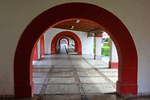
The Plaza takes up about 3 square blocks surrounding the church, which was also restored, the San Francisco Xavier chapel, a monumental crypt for Kino's burial site with murals of his life, a statue of Padre Kino, a large U-shaped Spanish style arcade with a Kino Museum and Library, religious article sales and other shops and restaurants. The town name was changed to Magdalena del Kino to celebrate the great discovery! The President of Mexico, Luis Echeverria Alvarez, who had taken a personal interest in this project, came to Magdalena and dedicated the completed Plaza on May 3, 1971.  Magdalena is now also a Pueblo Mágico, the second one in Sonora.

The Kino crypt has 4 windows to view downwards about 10 feet to view the skeleton of Padre Kino, who was buried along with two Padres from Mission Tubatama and 2 lay persons.  Along with the murals painted on the ceiling of the crypt, it is very impressive. 

The church is in very good shape and the adjacent San Francisco Xavier chapel is quite plain with a life-size figure of the Saint clothed in Franciscan garb lying on a sepulchre in the center. The faithful stand in long lines to touch this figure and some lift up the head and kiss it, in their devotion.  A relic of an arm bone is displayed nearby in a gold monstrance.  We found the story of the long path to the discovery of Kino's grave very interesting.


We left Magdalena de Kino later that morning and drove 58 miles to the US border and found only six vehicles ahead in our line—unheard of to have such a short line!!  A very pleasant female agent asked the usual questions, came inside to look around, announced that our RV was “awesome” and passed us without the usual detour to the dreaded “secondary” inspection.  We celebrated our speedy border passage a few minutes later with an all American cheeseburger at McDonald's in Nogales, Arizona!!  We were back in the good old US of A!!      More on Padre Kino coming in the next exciting post!

Friday, February 27, 2015

Alamos to La Aduana, Huatabampito and Yávaros, Sonora


A great side trip from Alamos is to the village of La Aduana about 9 KM west.  Aduana is Spanish for customs and the Customs office was situated here to collect the Spanish King's quinta or one-fifth of all the output of the many very productive silver mines in this area. Part of the fun of visiting here is the 3KM drive from the Alamos highway into Aduana when part of the road is down in the river bed! 

La Aduana was founded in 1664 when the richest silver mines in all of Mexico were discovered here.
Back in those times, over 5000 people lived in Aduana; today, there are only about 400 inhabitants.  The church in the plaza, Nuestra Señora de la Balvanera or Our Lady of Balvanera, was built after a Mayo Indian vision of a woman on top of a cactus.  When they piled up rocks to rescue her, a rich vein of silver appeared which was considered a miracle and started the silver boom here.    

Today when you visit the church, look on the right side wall outside and you'll see a large thriving cactus growing out of the wall about 12 feet up!   On November 12th of each year, there is a procession here of Mayo Indians and a celebration continues for 10 days to celebrate the miracle of La Aduana! 

Some of the mines are in hiking distance and the former smelter is across the river with its stack still standing and pieces of slag from the smelter all over the ground.  Ruins of former houses, current homes including several upscale homes, a small store, a B&B and two women's crafts co-ops are what you'll see in a drive to the town plaza.  The church, of course, is the highlight.  The craft co-ops are well worth a visit with many unique items like animals made from soda or beer bottle caps and much more!

On 2/26/2015, back on the Alamos highway headed west, we were now on the Ruta Sierra Mar, the highway from the mountains to the sea!  

Our destination is Huatabampito, (Hwhat-a-bam-pito) a small village on the Sea of Cortes, southwest of Navojoa and about 30 minutes south of the big town of Huatabampo.  This drive takes you through the rich agricultural areas of Sonora where wheat, corn, tomatoes and many other crops are grown on huge irrigated farms. 

This is also the homelands of the thriving Yaqui and Mayo Indians.  It's about a 2-1/2 hour drive to get to the beaches of Huatabampito.  

The village consists of a police post, a small store, an old fish processing plant, many upscale homes overlooking the beaches and the combination Miramar restaurant, hotel and RV Park.  We've stayed at the Miramar RV Park previously and enjoyed the solitude and beauty of the beach and ocean as well as the good food at the restaurant.  


The beach is one of several we've been to that have what appear to be grains of gold in the sand in or near the surf.  Near sunset, this effect is spectacular with trails of gold!  Small mounds in the tidal zone are the homes of ghost shrimp, clams and fiddler crabs.
We initially drove down the single dirt road of town that parallels the beach about 1-1/2 miles to see if there was anything new.  We only saw some new home construction or rebuilding since this place has been hit by hurricanes coming over from Baja since it is about the same southerly distance as Loreto in Baja.   The sunsets here are beautiful and there are flights of pelicans skimming the water, frigate birds, lots of gulls and small “peeps” like sanderlings. 
We had planned to stay here and relax and walk on the beach for two days but it became windy and we decided to only spend one night.

On 2/27 we headed out at 8AM for the nearby town of Yávaros, a small fishing village on a large estuary, Bahia de Yávaros, off the Sea of Cortes.  There is a very large fish processing plant here that supports the village. There are docks and support facilities for the large fish boats that work far out in the Sea of Cortes. 
A recently paved road circles one side of the bay with houses on the right side and  fishing pangas and fish cleaning stations on the water side.  What makes this place so spectacular is the variety of birds present and the huge numbers of birds!  There are brown pelicans everywhere, seeking  an easy meal, sitting on or mobbing pangas where the fishermen are pulling the fish out of their nets and everywhere on shore by the fish cleaning stations! 
Willets, White Ibis and Yellow-crowned Night Heron
In addition, we saw large groups of white pelicans, white ibis, snowy egrets, great egrets, cattle egrets, yellow crowned night herons, curlews, ducks, Brant geese, many shorebirds, stilts, many species of gulls and much more.  There are egret rookeries in the trees and birds in the mangroves that surround the bay.  
 
Cattle Egrets in the mangroves, Great Egrets and Snowy Egret
And of course, the human drama of hundreds of men and women and kids working on cleaning fish, going out in the pangas and working on nets.  We used our Sprinter van as a blind and drove on the (wrong side) water side of the street to take close photographs of the people, the fishermen and the birds everywhere.

An Alamos-based naturalist takes people out in pangas on ecotourism tours here in the bay to see the birds including blue footed boobies, which are a real treat!  None of the fishermen offered us a boat ride so we didn't get that viewpoint this trip, but I'm sure it could be arranged. 
We spent two hours here documenting the scene and always find it exciting, even though we've been here in the past.  From Yávaros, we headed north back to the popular beach town of San Carlos!  


ALAMOS--UN PUEBLO MAGICO!


In late February 2015, at the end of our 2015 Escapees Chapter 8 Mexican Connection Rally in Bahía de Kino, we and two other Rally couples drove about 275 miles southeast to the northernmost Spanish Colonial city of Mexico—Alamos, Sonora.  Lin first came here in the 1960s when his parents used to visit for a week or two in winter.  He's still hooked on Alamos and has shared that magnetic attraction with Maryke with 4-5 visits over our 38 years of marriage.


The attraction of Alamos is easy to understand—the town is exceedingly beautiful!!  Then there are the friendly easy going people of Alamos and their pride in their town, the incredible history back to the 16th Century when the first Spanish expeditions of discovery passed through and eventually discovered the vast richness of silver in the hills, the wonderful architecture of the old mansions, the expats who have lovingly restored these beautiful old ruins, the beauty of the surrounding mountains, the glorious pink flowers of the amapa tree, all the colors of the rainbow in bougainvillea seen everywhere in town, the classic Plaza de Armas and its beautiful church.   And if that's not enough, consider the high status of Alamos as a Sonora Colonial Monument, a Mexican National Monument and its prestigious designation in 2005 as a Pueblo Mágico (Magical Town) joining 35 other historic or architecturally significant towns in Mexico like San Miguel, Guanajuato, Todos Santos and many other famous towns!  185 buildings in Alamos are listed as historic monuments!


Alamos is a town of about 13,000 inhabitants with about 30,000 people in the municipality.  It is the northernmost federally declared colonial city in northern Mexico.  About 350 Americans and Canadians live in Alamos in winter with about 100 remaining during summer or year round. Alamo was founded in 1684.  Its economy is based on mining, cattle ranching, agriculture, construction and tourism.  It is the ecological meeting place for desert, Sinaloan thorn forest and tropical deciduous forest, leading to an annual count of over 400 bird species.  Alamos is at 1460 feet elevation and its namesake mountain, Mount Alamos is 5700 feet high.  The name Alamos comes from the cottonwood tree native to this area.  The rainy season here is July- September.  Alamos is known as “La Ciudad de los Portales” or the City of Portals or arched building entry structures.  There are many, many arches in the historic center of Alamos.  Alamos is also known as the “Jumping Bean Capital of the World” since the brincadoras seed found in the hills contains a moth larvae that jump when warmed by the sun or in your hand!  They are harvested and shipped worldwide!  You can buy them on the plaza for 1 peso per bean!


As you drive toward Alamos from Navojoa, your first vision of the colonial city to come are the huge colonial-style entry arches several miles from town.  Driving on, you pass through an area of hotels, small shops and larger businesses, the Mercado de Artesanias selling crafts from all of Mexico, the Hospital and sports facilities.   Dolisa RV Park is on the left which was our Alamos headquarters.  In about another kilometer of homes and small shops, you'll see the Banorte bank and the Casa de Cambio for money exchange. Across the street is our favorite restaurant, Las Palmeras, with excellent food, atmosphere and reasonable prices.


You then reach a fork in the road. To the left is the Alameda, the main commercial part of town, containing the Mercado Municipal, the 1892 public market, a tortilla factory, many small taquerías and small refreshment stands, several small supermercados, a large plaza, the bus terminal and much more.  The right fork leads down a narrow old one way street, Francisco Madero,  that leads to the Plaza de Armas, the old Spanish military plaza, with the church on one side, formerly grand homes on the other 3 sides, now hotels or shops and the park in the center with its tall palms and the beautiful kiosk or bandstand. Come at night to see a warm, colorful view of the kiosk as well as the whole Plaza!  Lay your camera down (gently) on the floor of the kiosk with lens up in the exact center and gently push the shutter button to photograph the complete circle of art over your head.  

Most Plaza buildings were constructed during the late 1700s-early 1800s. 
The Museo de Costumbrista featuring the history, people and customs of Alamos and Sonora, including mining, is on the far side as you enter with the Tourist Office to its right.  The Tourist Office, beyond a map and brochures, is the place to find a licensed guide. We chose Emiliano Grajeda for both a City Walking Tour with lots of history and later, a Mayo Indian Village Tour that was a great day out in the country seeing many interesting people and places at reasonable cost.  The Amigos de Educación de Alamos runs a Home and Garden Walking Tour going to 3 restored Alamos homes on Saturday morning 9:30AM at the Museum on the Plaza for $10US.  Proceeds go to scholarships for needy Alamos high school students.  Many curio stands are to the left and several refreshment stands operate around the plaza.  Several guided tour vehicles operate from the Plaza: The Red Train, a motorized (fake) horse carriage, and a large 1920s style car.   

Most hotels are within a block or two of the Plaza de Armas.  

The Palacio Municipal is to the right of the church just off the plaza and contains the city offices, the municipal offices and post office.  A large stage in the Palacio is used for many public performances including the annual January Tirado Music Festival.  The Palacio Municipal is impressively lit at night with LED lights in the front in the Mexican flag colors of red, white and green! 
Outside lights and inside court of Palacio del Gobierno
The church on the Plaza de Armas, officially Iglesia Parroquía de Nuestra Señora de la Concepción, the parish church of Our Lady of the Immaculate Conception, replaced an old adobe church on the site, when construction began in 1786.  
The church is still in daily use, the church bells ring for mass, deaths, funerals or extraordinary happenings in town.  The clock is an unusual church feature and was brought from Rome and is very old.  Currently it is keeping very accurate time! Before the Mexican Revolución, the church was more ornate inside and outside with gold plated statues in the facade niches and seals of the Spanish King which were obliterated.  Many churches were looted during those years, but Alamos was fortunate in suffering minimal damage.  Be sure to walk completely around the church seeing the dome, the large tower with the bells, the cross and weathervane on top and the flying buttresses.  The inside is very impressive also.  


The church would have become a cathedral but Bishop Reyes died before the church was completed and a new bishop was never appointed!  Come back at night to see the lighted church, the lighted gazebo and most of the Plaza de Armas. 
Little girl hanging out at the Gazebo and Mexican Fashion photography on the Plaza

While we were in Alamos this trip, a 5K run, a political candidate rally, and a classic car show all occurred in the Plaza de Armas.  One of the features of the run is everyone got a small bag of color chalk dust to throw on other runners or to color the streets and the plaza---lots of green and purple people later!  The next day a city crew was out, pressure washing the streets!  Alamos has many events and celebrations throughout the year and most happen in the Plaza de Armas.  

Alamos is very clean and also very safe, day or night!
Get a map from the Tourist Office and just walk and enjoy the great architecture, the colors and the friendly Buenos Días or Buenos Tarde you'll want to exchange with the Alamos locals.  The town is organized into 16 or more barrios or neighborhoods and it is fun to walk along the streets and peer into open doors and gates to see beautiful patios, landscaping, shrines and restored old homes. 
Emiliano, our guide and the "Kissing Alley"
All the Spanish explorer heavy hitters seem to have had a part in the history of Alamos!  Alamos history begins in 1533 when Diego de Guzmán was the first European to pass through Alamos. Next in 1540 Vasquez de Coronado passed Alamos while exploring northern Mexico. Alvaro Nuñez Cabeza de Vaca explored here traveling from the North.  In 1683, the richest find of silver in Mexico was discovered in La Aduana and European settlement followed. 1684 saw the founding of the city of Alamos.  1687 Padre Kino came to Alamos seeking funds for a chain of missions in northern Sonora, Arizona and California.  The 1700s saw prosperity in Alamos from the mines, cattle ranching and agriculture. 1750 the Spanish Surveyor General was sent to Alamos by the King of Spain to lay out the city streets.  A Royal Treasury was established in 1769 in Alamos to collect “el quinto real” the royal fifth of the gross output of the silver mines for the King of Spain.  In 1776, Captain Juan Bautista de Anza with 177 settlers from Alamos led a colonizing expedition to San Francisco, California!  1780s Alamos is the richest city of Sonora and population reaches 30,000!  An expedition to settle Los Angeles leaves in 1781 with 44 people from Alamos!  1786 Bishop Reyes begins building the present church which is finished in 1803.  1828-1832 Alamos becomes the capital of Occidente, the combined area of Sinaloa and Sonora!  1864 The Mint is established in Alamos.  1865-66 Emperor Maximillian's French troops take control of Alamos until Mexican forces regain control.  1886 Telegraph service begins.  1907 The train line comes into Alamos.  1910-20 the Mexican Revolución closes the mines.  Pancho Villa's troops enter Alamos in 1915 with minor destruction noted.  1946 to present—Americans come to Alamos, open first hotels and restore many of the old houses.  1951 Highway 15 from the U.S. border completed to Navojoa. 1958 First bank opens and telephone service begins.
(Timeline facts from"The Alamos Guidebook" 2009 4th edition)


Miscellaneous Local Color Department

El Mirador--The best view of Alamos is from the Mirador, a hill about 200 feet high with a 360 degree view.  You can easily see where you've been and where you want to go next from the Mirador.  We traced the foot route to the Panteón or cemetery and took the long hike there the next day. 
Amapa Trees--We visited Alamos at the end of February 2015 and because of earlier rain, the extremely colorful pink (and rarer yellow) amapa trees were in full bloom all over the hills and mountains. The Mirador viewpoint allows you to see many of these trees. 
Bougainvillea--The other color to be seen everywhere in every barrio or up at the Mirador is bougainvillea in a kaleidoscope of colors all over Alamos! 


Bakery Sales Kids--The local bakery, Panadería Moderna, across the arroyo, sends out kids all over town with tables carried on their heads, containing sweet rolls hot from the oven for sale!  The photograph of 2 kids with tables shown here has water mist in the background from the city crew pressure washing the Plaza!!
Phariseos/Fariseos--Since we visited Alamos at the beginning of Lent, we had several encounters with Pharisees on the street. These are groups of 3-5 Mayo or Yaqui men selected by village elders. They vow to be mute, abstain from sex, not wash their clothes and walk a route in silence selected by the elders for the 40 days of Lent. They wear a costume and masks around towns, move to a drumbeat and hold out a can for donations.  A donation cleanses you of sins!  We have seen them in several towns and been amply cleansed!
Religious Shrines—Shrines to Our Lady of Guadalupe large and small, grand or poor, they are everywhere in Alamos, on houses, buildings, at street corners and many other locations.
 
Hummingbirds—With so many blooming plants all over Alamos, many with trumpet flowers, there are definitely hummingbirds here!  In RV Park Dolisa, where we stayed fo 6 nights, Lin discovered a  Broad billed Hummingbird  coming back and forth to a tree 25 feet in front of our RV.  In the tree's lower branch about 7 feet high was a tiny woven nest of a Costa hummingbird sitting on her eggs!  Incidentally, lesson learned, don't park under a mango tree, because it drops large quantities of debris and some kind of “juice” that sticks to the windshield!  


La Estudiantinas---formal name La Estudiantina Dr. Alfonso Ortiz Tirado, founded in 1989, with its first      performance at the 1989 Tirado Music Festival.  10-20 young men dressed in 13th Century Spanish costumes perform with string and percussion instruments and a small accordion. They dance and sing, as a group or singly with Spanish songs.  Many of their songs praise feminine beauty or are comical.  At the performance we attended at Casa de los Tesoros Hotel on 2/24/15 at the suggestion of our guide Emiliano, about half of the group of 10 Estudiantina came out in the audience of a large American Trafalgar tour group and danced with women individually and then formed a conga line with many of the tour group that went around the large patio several times.  We have seen them twice before and really enjoyed them again!

Alamos is a wonderful Mexican town to visit with much to do and almost everything is in easy walking distance.  History comes alive here as you walk the cobblestones!
DOORS OF ALAMOS